Capability Enhancements
In FY 2016, HSIN implemented two major capability enhancements—delivering Homeland Infrastructure Foundation-Level Data (HIFLD) Secure and developing and launching HSIN Exchange—responding to the need to make vital information more accessible. The program streamlined RFIs and geospatial critical infrastructure data, making it readily available to HSIN users through a single point of access. Because of these enhancements, the HSIN Program has increased opportunities for information sharing, bridged communication gaps between agencies, and delivered solutions that make information sharing faster and more efficient.
HSIN Exchange
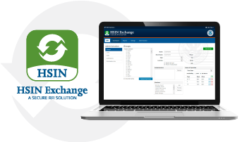
 Working with partners at DHS, the Terrorist Screening Center and the National Network of Fusion Centers, HSIN created a streamlined, mobile-compatible RFI solution, called HSIN Exchange. This simple, cost-effective solution empowers law enforcement and intelligence analysts with the tools they need to do their jobs more efficiently.
Fusion centers rely on HSIN every day to share intelligence products, collaborate on cyber threat response strategies and to support real-time communications during incident response and event management operations. HSIN Exchange strengthens interagency collaboration, makes it possible for users to share information in real-time from any location and provides shared services, interoperability and a common operational picture. Launched in the summer of 2016, HSIN Exchange supports RFI-related communications between all 78 fusion centers nationwide and the TSC.
In addition to providing the platform for secure RFI information sharing through HSIN Exchange, HSIN offers solutions to bridge the gap between agencies. By speeding up the RFI process, mission operators have access to the information they need sooner and the ability to transition tasks between shifts more efficiently. The first stage of the operational deployment of HSIN Exchange focused on supporting RFIs between the National Network of Fusion Centers and the TSC. Future partners include the HIDTA and Regional Information Sharing System (RISS) centers.
IP Gateway
This year, HSIN completed the federation with IP Gateway, increasing security through a HSIN-credentialed log-in capability. Through this partnership, HSIN simplified access to critical information while providing a secure platform for ongoing information sharing and collaboration while also providing enhanced identity management and access control capabilities. HSIN credentials provide the IP Gateway with enhanced security and multi-factor authentication capabilities that are inherent to the identity management and access control structure of HSIN. Through the federation with HSIN, more than 5,000 IP Gateway users rely on HSIN accounts for access. When IP Gateway users are included, the total number of HSIN accounts added in FY 2016 exceeds 20,000.
HIFLD Secure
The HSIN Program partnered with the DHS Geospatial Management Office (GMO) to provide users access to the most up-to-date geospatial data available. This partnership made it possible to visualize information through the lens of location so that mission owners and operators could analyze and interpret data to gain valuable understandings of relationships, patterns and trends. The HIFLD Subcommittee, which is supported by the GMO, develops, promotes and executes a coordinated strategy for acquiring and generating geospatial information about critical infrastructure. In FY 2016, access to this data was simplified through the release of HIFLD Open and HIFLD Secure.
HIFLD Open launched in February 2016 and contains 275 publicly available data sets. HIFLD Secure represents the best available geospatial foundation infrastructure data to support community preparedness, resiliency, research and more. Comprised of all the For Official Use Only (FOUO) and licensed critical infrastructure data, HIFLD Secure is maintained within the secure HSIN environment as part of the Geospatial Information Infrastructure community. The HSIN Program plans to build on this foundation to provide more layered mapping information and Geographic Information Systems functionality options in FY 2017.

 Working with partners at DHS, the Terrorist Screening Center and the National Network of Fusion Centers, HSIN created a streamlined, mobile-compatible RFI solution, called HSIN Exchange. This simple, cost-effective solution empowers law enforcement and intelligence analysts with the tools they need to do their jobs more efficiently.
 Commander Ted Fries
 Jessica Garcia
 Peter Hoffman
 Sgt. Anthony Jones
  Brian Quinn
 Caitlin Durkovich
 Greg Hayes
 Sarah Edie
 Mike Sena
 Command Intelligence Officer Lt. Scott Branner
 C.J. Noelck
 Lieutenant Tim Burkett