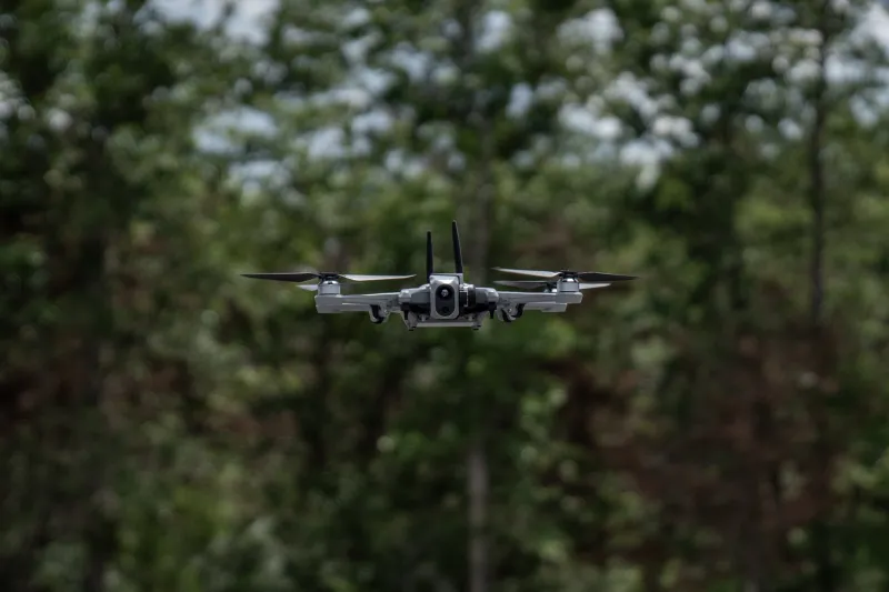
The Science and Technology Directorate (S&T) and its National Urban Security Technology Laboratory (NUSTL) are conducting operational assessments of select unmanned aircraft systems (UAS) from the Blue UAS Cleared List to determine how these state-of-the-art technologies can support first responders in the field.

Drones are revolutionizing public safety by enabling quicker, safer, and more effective responses by our nation’s first responders. But some drones present cybersecurity risks and broader implications for national security. To safeguard against any harm, it is critical that responders understand which drones mitigate these cybersecurity risks and can adequately perform the needed public safety operations.
In June, NUSTL and a coalition of public and private partners braved the sweltering Texas heat to assess cybersecure “Blue UAS” that help first-on-scene responders conduct a wide range of public safety missions. The collaboration, part of S&T’s System Assessment and Validation for Emergency Responders (SAVER) Program, brought the lab together with Mississippi State University’s Joint Unmanned Systems Testing in Collaborative Environment (Project JUSTICE), Texas A&M University, DAGER Technology LLC, and others to determine if Department of Defense-vetted UAS systems also meet the growing needs of our nation’s responders. To learn more about Blue UAS for first responders, check out SAVER’s TechNote.
The SAVER Blue UAS assessment was the first in a series of operational assessments at sites across the country designed to evaluate systems along with their cameras (both infrared and electro-optical), data sharing/streaming capabilities, and overall flight capabilities. The goal of the assessment in Texas was to determine how effectively each system aids in search and rescue operations, damage assessment, and situational awareness missions in rural environments.
Take a peek behind the scenes as the tests unfolded over the course of a week at Texas A&M’s Engineering Extension Service (TEEX) campus in College Station, Texas. The photos below offer a look at the assessment activities, the technologies, and the rural terrain of “the friendly state.”

“First responders are consistently presented with unique, potentially dangerous environments and situations when responding to calls,” said NUSTL Program Analyst Kris Dooley. “The standoff capability that a drone can provide is a valuable resource, as it provides an aerial vantage point to mitigate potential safety threats and inform response tactics. Therefore, it’s important that we work closely with responders to test these UAS in simulated operational scenarios to understand the capabilities of these systems.”

During the assessment, dozens of flights were conducted during day and night operations and across different operational scenarios, weather, and environments. “This allowed the first responders to evaluate whether the selected UAS would be suitable for deployment and help with critical tasks such as surveying post-emergency incident damage, locating missing people and providing essential information like disaster site accessibility, existing hazards, and environmental and contextual data,” explained Dooley.

The first responder evaluators implemented three simulated operational scenarios: post-incident damage assessment, situational awareness, and nighttime search and rescue.

The post-incident damage assessment scenario required operators to fly drones over sites at ‘Disaster City’ that simulated earthquake and building collapse damage at TEEX’s Brayton Fire Training Field. To further create a realistic scenario, the sites contained rubble piles, collapsed floors, theatrical smoke, damaged vehicles, debris, and mannikin ‘victims.’ UAS operators were tasked with using UAS cameras and video feeds to inspect buildings for damage, locate victims, identify potential hazards, and share mission-critical information with teams on the ground to support situational awareness on scene.

“For the situational awareness scenario, UAS were launched and flown over a suburban environment with wooded areas, parking lots and various building structures that were outfitted with vehicles and mannikins posing as hostages or trapped persons,” explained Dooley. “The evaluators tested the UAS to gauge how accurately they could assess this type of environment to gather and share essential information, such as the presence of victims or bad actors and details of the scene such as vehicle types or license plates, as well as items of interest like firearms, explosives, or hazardous materials.”

The nighttime search and rescue scenario took place at Texas A&M’s RELLIS test facility, kicking off at dusk and continuing into the night.
“Evaluators launched UAS and flew them over nearby forests, ponds, and rivers to look for two ‘missing persons,’” said Dooley. “They relied on the camera and the thermal imaging capabilities of the systems to assist with locating missing persons and focused on the covertness of the UAS during these operations.”

“This rural assessment was highly successful. We walked away with results that will help inform the national first responder community on the capability and usability of the Blue UAS platforms assessed,” explained Dooley. “We plan to conduct further evaluation of these technologies in different environments and operational conditions to find out which platforms are suitable for responders during real-life operations.”
While the rural assessment is over, there is still much more work to do. The data collected and analyzed from these evaluations will provide a baseline of information about the selected UAS and their capabilities and limitations when it comes to supporting responders in the field. Up next is a second blue list UAS assessment in an urban environment, where different topographies and landscapes (like neighborhoods, powerlines, and urban canyons) will pose a new set of challenges.
“With the testing and results from TEEX, we now have a point of reference to compare these systems and others to when tested in urban environments and terrains.” said Dooley.
Results from this assessment and future assessments will be compiled, analyzed, and shared on the SAVER website.
For related media requests, please contact STmedia@hq.dhs.gov.
