Six firefighters lost their lives responding to a fire in a century-old, abandoned warehouse in Worcester, Massachusetts, in December 1999. Worried that civilians were trapped inside, rescue teams initiated a rapid intervention; but, unfamiliar with the layout of the building, the smoke-filled warehouse became a labyrinth for those that entered. Unfortunately, the brave individuals that answered this call were unable to locate any exits before they ran out of air.
We still remember them more than two decades later, and this incident—along with hundreds in the years since—served as the catalyst for groundbreaking new Department of Homeland Security Science and Technology Directorate (S&T) tracking and location technology. Precision Outdoor and Indoor Navigation and Tracking for Emergency Responders (POINTER) will soon allow agencies to pinpoint their firefighters to within centimeters, helping to navigate them quickly and safely out of potentially disorienting emergency scenarios.
 “From containing small kitchen fires to carrying civilians out of burning homes to securing local infrastructure, first responders put their lives on the line daily to ensure the safety of their communities,” said Greg Price, who leads S&T’s first responder research and development programs. “The reality is, even with all of the advances made in firefighting technology, we still lose far too many firefighters each year. We want them to know that we have their backs, that we are working to give them the tools they need to ensure their own safety. POINTER is that solution.”
Throughout the development of POINTER, S&T has not only been designing the technology for responders, but with them as well—including firefighters in Worcester.
“We have tested many different technologies, finding them not very accommodating to our needs for one reason or another” said Chief Michael Lavoie of the Worcester Fire Department. “Mostly, the equipment was bulky and would work in some situations, but not all. However, experimentation over the last 21 years has brought technological advances in this area and we are pleased to have been asked to field test the POINTER system.”
S&T has collaborated with the NASA Jet Propulsion Laboratory (JPL) in Southern California and first responder stakeholders since 2014 to develop POINTER, a wearable and portable, cost-effective tracking and location technology that leverages cutting-edge science to succeed where existing products may fail.
For instance, technologies that use GPS, acoustic sensors, radio location, radio-frequency identification, ultra-wideband radar or other methods often lose signal or face position drift in line-of-sight denied environments. Many can’t penetrate through certain building materials or even reach underground. POINTER can do all of this and more, making it both more accurate and reliable.
POINTER uses magnetoquasistatic (MQS) fields to three-dimensionally track and locate responders in low-visibility environments. “MQS fields are not blocked or reflected by the materials found in most buildings due to weak response of the materials to magnetic-dominant fields,” said Dr. Darmindra D. Arumugam, principal investigator and senior technologist at NASA JPL. Dr. Arumugam developed the theory, technique and algorithms that can analyze both the electrical and the magnetic components of MQS fields so they can be utilized by POINTER. “This presents a significant difference to how remote wave-based position sensing works and performs.”
 The POINTER system operates in three parts:
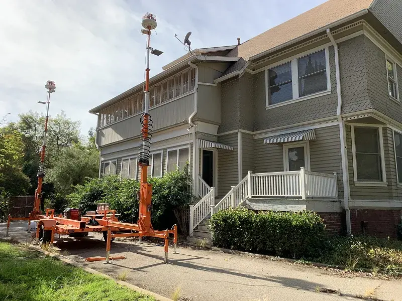
- Transmitter: This technology based outside at incident command generates the MQS fields that geolocate the responders. Complex sensors and algorithms solve for position and orientation, tracking responders to the precise floor they are located on from up to 70 meters away.
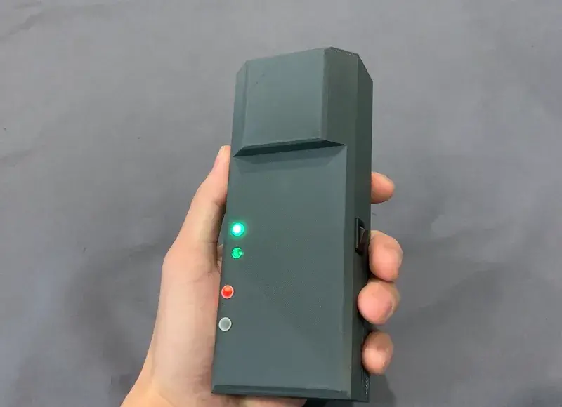
- Receiver: As they enter a burning structure, firefighters wear a device, currently the size of a smartphone but that ultimately will be even smaller, that is wirelessly connected to the transmitter. MQS fields ping the receivers on each responder and send data back to command.
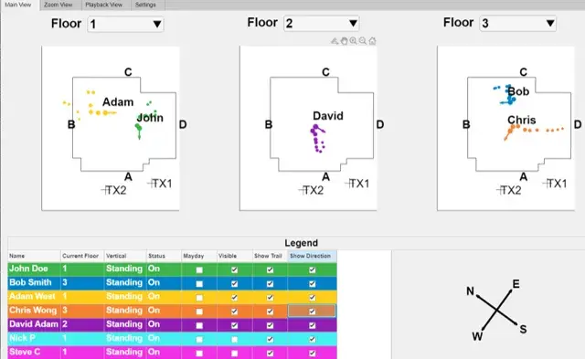
- Base Station: A laptop computer located at incident command houses a visualization component that shows the responders in real time, pointing out whether the individual is still, moving, or down within the structure and informing whether intervention may be needed.
S&T’s First Responder Resource Group, an advisory body of responders from across the country, expressed that this type of technology is a top priority because of the lives it will save. Because responder input is so critical, S&T has worked hand-in-hand with them from the start to build this system to their specifications. Since development began, POINTER has evolved from a technology that could track first responders to within three meters of accuracy to now locating them within centimeters of their actual position.
 S&T, NASA JPL, and industry partner Balboa Geolocation Inc. continue to work closely with these and other first responders from across the country to operationally test POINTER. Most recently, successful tests of POINTER technology were conducted in a 5-level, 8,000 sq. foot structure with very promising results.
“The success of these tests signals the first step towards commercial availability in 2022,” added Price.
Throughout 2021, S&T, NASA JPL and first responders will continue testing POINTER in additional simulated response environments, including rural 2- to 3-story houses, row homes and town houses, and warehouses. By year’s end, the goal is to put POINTER prototypes in the hands of departments in cities across the country (like Worcester) that can validate its accuracy in their own training and operational environments.
“I’m sure I speak for the entire Worcester Fire Department when I say that we are extremely excited to begin the testing process with the development team and DHS,” said Chief Lavoie. “It is my hope that we have finally arrived with a system that works in all settings so that no fire departments will have to suffer the same losses that we experienced.”
