Out of the approximately 90,000 dams in the United States, roughly 90 percent are state, municipal or privately-owned. That makes two-thirds of the dams in America—regulating the flow of canals, generating power and protecting communities from flooding—subject to greater variation in safety standards and disaster preparedness than the rest.
 The Department of Homeland Security (DHS) Science and Technology Directorate (S&T) has been researching ways to minimize risk from a dam failure and improve the response capability of stakeholders in affected areas. The Kentucky Division of Water and S&T’s Flood Apex program are working together to establish a means of monitoring dams and alerting the communities and property owners of potential dangers. This is a lengthy process that involves understanding the shortcomings of available dam-related information and the technologies available to fill the gaps.
“It’s very low-probability, but extremely high-consequence,” said Carey Johnson of Kentucky Division of Water, working with the DHS S&T to improve the safety and awareness of these dam-centric communities nationwide.
Because the likelihood of a dam failure is expected to be minimal, communities and property owners surrounding dams might easily embrace their land as any other lake-side or ocean-side residence. The truth, however, is that if these dams were to fail, the volume and force of water could compare to a small tsunami affecting nearby towns and residences. Because these are state, local, and privately-owned dams, recovery efforts would ultimately come at the expense of local taxpayers and dam owners.
Twenty-five dams failed when Hurricane Matthew hit South Carolina in 2016, resulting in significant damage to homes and downstream infrastructure. This was only a year after 51 state-regulated dams failed in the historic floods of 2015. Events like these have spurred the need for increased awareness of state, local, and privately-owned dams, and better preparation and risk communication in surrounding communities.
“The breaches during Hurricane Matthew are an example of what we want to be ready for,” said Dr. David Alexander, S&T Flood Apex Program Director, “The right precautions, monitoring and warnings could help us reduce injuries, fatalities and property losses.”
The Kentucky Division of Water has already begun a four-phased approach to help fulfill these needs. Sites will be selected, their risk evaluated in the early stages, and what follows will be a survey of instrumentation options, a plan for implementation, then development of prototypes for flood sensors and notification systems. Through this process, S&T can be better informed on dam safety monitoring and possibly ignite further efforts toward developing standards and technology solutions for federally and municipally owned dams.
 In the process of seeking locations for the implementation of sensors and other instrumentation, the Kentucky Division of Water has already identified 13 sites as having some kind of instrumentation capacity or need. Meanwhile, S&T works to establish criteria for affordable instruments before developing and testing them. In the evaluation phases, testers will act out potential response scenarios to simulate a live disaster response, allowing operators to familiarize themselves with the new technologies being implemented at their locations.
The instrumentation in the works by the S&T Flood Apex program will consist mainly of sensors to monitor water levels, which will communicate warnings to surrounding communities. Identifying the ideal sites for implementing these will allow for multiple sensors placed at different sections of the stream. To further elaborate on their warning system, Kentucky Division of Water is also looking into instrumentation such as “seismic sensors” which can not only monitor the levels but the force of water.
“The explosive force of water when a dam fails is even more critical than water levels,” said Johnson.
Internet of Things (IoT) sensors, connecting dam infrastructure to community information systems, along with other analytical tools, will help communities better prepare for dam failures by allowing them to invest in the right response and recovery strategies, and even plan ahead to prevent floods from happening. In the actual event of a breach, communities may be given timely notice, saving lives and injuries by allowing people to evacuate promptly and responders to be ready where they are needed.
“Sensors will record how the height of the water is changing, and based on certain rules we can identify the locations of those sensors,” said Alexander, “A system like this could increase community resilience to disruptions caused by flooding.”
This kind of monitoring is less expensive and simpler than anything these communities have used in the past. Because these dams are owned by various entities, prior attempts at preparedness have been disjointed. Here, S&T hopes to help Kentucky Division of Water establish a cost-efficient, uniform method of keeping communities and property safe from dam-related risks.
If all goes as planned, S&T will be able to share lessons-learned from these efforts in other areas of the country susceptible to the failure of state, local and privately-owned dams.
“Raising awareness is one of the most important elements here: we want communities surrounding dams to know that they live near a dam and not a lake,” said Johnson, “and we want those people to be wary of what could happen if the dam fails using live updates, because downstream consequences can be catastrophic.”
This is just another case of an S&T partnership benefitting communities around the country, as innovation fills the gaps between governments, businesses and neighborhoods.
Photo Captions:
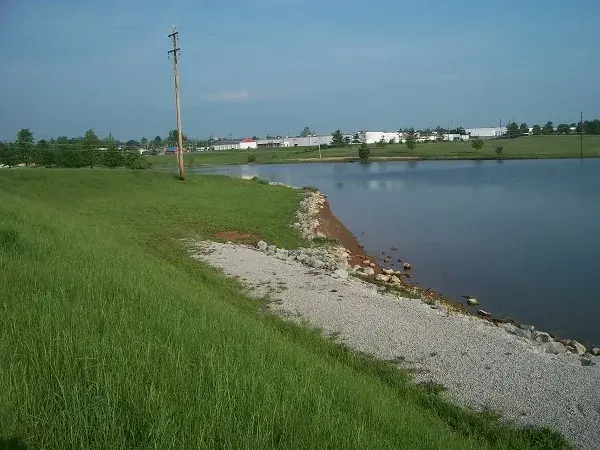
1. Taken by Stantec of Freeman Lake Dam in Elizabethtown, KY in 2011 showing a view of wave wash erosion area, near Emergency Spillway Inlet.
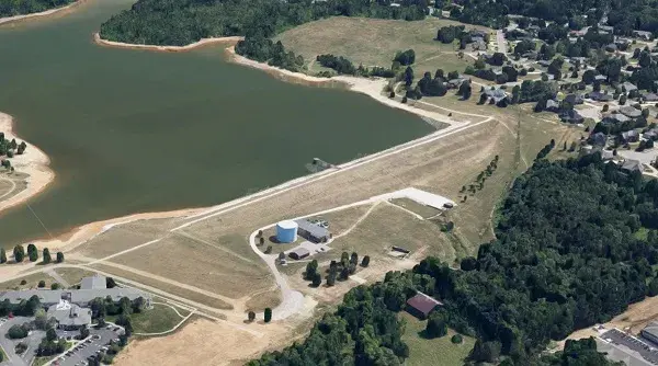
2. Google Earth Image of Freeman Lake Dam. The attached was taken by Stantec in June 2006 of Freeman Lake Dam showing the bridge to the concrete riser structure. If you wanted one more recent.
